General remote sensing in natural environments
from archaeology to reservoirs and everything in between
Our remote sensing work spans a wide range of natural environments, from archaeological landscapes to reservoirs and beyond. We support projects involving bathymetry, sediment thickness estimation, satellite-based water quality monitoring, and large scale reservoir analysis through a uniquely integrated approach.
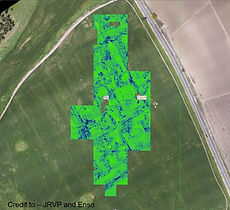
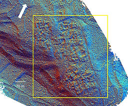
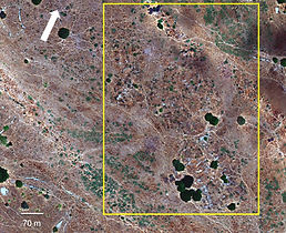
In archaeology, effective remote sensing demands more than technical skill. It requires an understanding of archaeological context, methods, and real world constraints. Enso has deep experience applying multispectral, thermal, and LiDAR technologies to archaeological research, revealing near-surface features, mapping beneath dense vegetation, and identifying terrain expressions linked to sub surface structures. We offer end to end solutions, including the scanning of complex, GPS-denied environments such as caves, canals, and ancient subterranean spaces.